



Photo: Silvia costa1997, CC BY-SA 3.0 · Wikimedia Commons
Castle, 14th century
Rocca Estense
Rocca in San Felice sul Panaro, Italy
At a glance
- Type
- Castle
- Period
- Middle Ages, 14th century
- Protection
- Italian national heritage
- Coordinates
- 44°50′20″ N, 11°08′28″ E
- Address
- Via Mazzini
History and description
The Rocca Estense is a castle in San Felice sul Panaro, a comune (municipality) in the Province of Modena in the Italian region Emilia-Romagna. It is located about 40 kilometres (25 mi) northwest of Bologna and about 25 kilometres (16 mi) northeast of Modena.
History
Construction of the castle began in 1340 on the orders of the Marquis Obizzo III d'Este and took about twenty years to complete. In the following century, it was restored and further fortified by order of the Marquis Niccolò III d'Este, who commissioned the work from the military architect Bartolino da Novara.
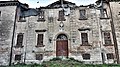
The region was struck by two earthquakes in May 2012. The first earthquake, with a magnitude of 6.0, occurred on 20 May 2012 and severely damaged the castle.
In January 2018, the restoration project of the fortress was presented, with an estimated cost of 6.6 million euros.
Text from Wikipedia, the free encyclopedia, under CC BY-SA 4.0. Full article: «Rocca Estense».
Timeline
- 14th centuryBuilt
Events and people from Wikidata (CC0).
Photos
Getting there
San Felice sul PanaroTrain, nearest
500 m as the crow flies
Rocca EstenseVia Mazzini
Aeroporto di Bologna "Guglielmo Marconi"35.8 km
Distances are as the crow flies, not walking or driving.
Loading map…
Nearby
See on the mapMore castles in Emilia-Romagna

- Free 1st Sunday


Frequently asked questions
Where is Rocca Estense?
Rocca Estense is in San Felice sul Panaro, in the province of Modena (Emilia-Romagna), Italy. Address: Via Mazzini. GPS coordinates: 44.83893, 11.14122.
How old is Rocca Estense?
Wikidata dates it to the 14th century.
What else is there to see near Rocca Estense?
Nearby you’ll find: Torre dell'Orologio (100 m away), Villa Ferri (200 m away), Castello Carrobio (5.4 km away).
Sources and licences
Text. Wikipedia, the free encyclopedia (CC BY-SA 4.0).
Data. Wikidata (CC0); opening hours and contacts OpenStreetMap (ODbL).
Photos. Wikimedia Commons, author and licence on every image.
Credits for the 9 photos
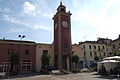
- Rocca Estense dopo il terremoto — Silvia costa1997, CC BY-SA 3.0
- Entrata principale della Rocca Estense dopo il terremoto — Silvia costa1997, CC BY-SA 3.0
- Rocca Estense di San Felice Sul Panaro (7385053628) — Mirko Masi from Italia, CC BY 2.0
- Rocca Estense di San Felice Sul Panaro situazione dal 20-29 05 2012 — Giorgio Bocchi, CC BY-SA 4.0
- Rocca Estense illuminata — Giorgio Bocchi, CC BY-SA 4.0
- Rocca Estense lato sud 21 05 2012 BG — Giorgio Bocchi, CC BY-SA 3.0
- Rocca Estense prima del terremoto del 20 maggio 2012 — Tommaso Trombetta, CC BY-SA 3.0
- Rocca Estense — David Alexander (University College London Institute of Risk and Disaster Reduction), CC BY 2.0
- San Felice SP La Rocca Estense 2 — Tizianok, CC BY-SA 3.0
Updated 28 October 2026. All sources and licences