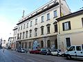


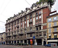


Fortress / Tower, Milan (MI)
45°27′07″ N, 9°11′47″ E
No photo on Wikimedia Commons yet
At a glance
- Type
- Fortress / Tower
- Coordinates
- 45°27′07″ N, 9°11′47″ E
About
Porta Vigentina was one of the city gates in the Spanish walls of Milan, Italy; the gate has since been demolished, but the phrase "Porta Vigentina" is still used to refer to the district ("quartiere") where the gate used to be. The area is part of the Zone 5 administrative division of Milan.
The gate controlled access to Milan, via the "Strada Vigentina" road, connecting the city to Pavia. The road was named after the town of Vigentino (now part of Milan), located some 20 miles from Pavia.
Text from Wikipedia, the free encyclopedia, under CC BY-SA 4.0. Full article: «Porta Vigentina».
Getting there
Milano TibaldiTrain, nearest
1.2 km as the crow flies
Porta Vigentina
Aeroporto di Milano-Linate5.8 km
Distances are as the crow flies, not walking or driving.
Loading map…
Nearby
See on the mapDo you know this place?
We are missing the opening hours and photos. The data comes from open projects: if you add it there, it appears here at the next update.
More fortresses and towers in Lombardy


- UNESCO

- UNESCO

- UNESCO

Frequently asked questions
Where is Porta Vigentina?
Porta Vigentina is in Milan, in the province of Milano (Lombardy), Italy. GPS coordinates: 45.45194, 9.19639.
What else is there to see near Porta Vigentina?
Nearby you’ll find: Teatro Principe (200 m away), Palazzo Calchi (300 m away), Palazzo Binda (300 m away).
Sources and licences
Text. Wikipedia, the free encyclopedia (CC BY-SA 4.0).
Data. Wikidata (CC0); opening hours and contacts OpenStreetMap (ODbL).
Photos. Wikimedia Commons, author and licence on every image.
Credits for the 1 photos
- Corsocomo9 — LucaChp, CC BY-SA 3.0
Updated 28 October 2026. All sources and licences