




Photo: Rodolfo Lanciani, Public domain · Wikimedia Commons
Fortress / Tower, 4th century BC
Porta Capena
A gate in the Servian Wall in Rome, Italy
- Within the UNESCO World Heritage Site “Historic Centre of Rome, the Properties of the Holy See in that City Enjoying Extraterritorial Rights and San Paolo Fuori le Mura”
At a glance
- Type
- Fortress / Tower
- Period
- Antiquity, 4th century BC
- Coordinates
- 41°53′02″ N, 12°29′26″ E
History and description
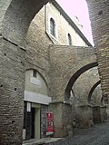
The Porta Capena was a gate in the Servian Wall in Rome, Italy.
The gate was located in the area of Piazza di Porta Capena, where the Caelian, Palatine and Aventine hills meet. Probably its exact position was between the entrance of Via di Valle delle Camene and the beginning of Via delle Terme di Caracalla (known as the "Archaeological Walk"), facing the curved side of the Circus Maximus.
Nowadays Piazza di Porta Capena hosts the FAO Headquarters. Between 1937 and 2004, it was home to the obelisk of Axum.
History
The valley around what is now the avenue of the Baths of Caracalla was in ancient times covered with woods, caves, and freshwater springs.
In this area (called the valley of the Camenae), considered sacred and mysterious, it is said (and Livy punctually reports) that the peaceful king Numa Pompilius, the first successor of Romulus, had his nocturnal encounters with the goddess (or nymph) Egeria, who on those occasions provided him with all the necessary information for the institution of the rites most pleasing to each divinity, as well as the related priestly functions.
Whether he was in good or bad faith, with this expedient the king managed to keep calm for several years a rough and ignorant people, who could not let off steam in the war. Therefore, this area can be considered the cradle of the religion of ancient Rome.
Its location and some testimonies suggest that the gate was originally called Camena and that its construction may even be earlier than that of the Servian Wall.
The first historical-legendary mention dates back to the time of King Tullus Hostilius (mid-7th century BC): it refers to the fact that the funerary monument to Horatia – the sister of the Horatii, killed because she was guilty of falling in love of one of the Curiatii – was erected close to the gate.
In 489 BC, it was from Porta Capena that a multitude of young Volsci was driven out of Rome, while they waited for the games, according to the project of Coriolanus to foment their animosity against Rome and prepare for the subsequent war.
In 312 BC the Appian Way was built, starting from the gate and having the city of Capua as its arrival point: for this reason, the name of the gate was changed into Capena and the whole area, already relevant for various reasons, assumed a very important role as a major point of transit and contact with southern Italy.
In literary evidence, the gate is also mentioned for another important event that deeply marked the history of Rome: as Livy reports, after the disastrous battle of Cannae, the Senate met to assess the situation "ad portam Capenam", which was one of the three meeting places of the assembly. …
Text from Wikipedia, the free encyclopedia, under CC BY-SA 4.0. Full article: «Porta Capena».
Timeline
- 4th century BCBuilt
Events and people from Wikidata (CC0).
Photos
Getting there
Roma OstienseTrain, nearest
1.4 km as the crow flies
Porta Capena
Aeroporto di Roma-Ciampino12.7 km
Distances are as the crow flies, not walking or driving.
Loading map…
Nearby
See on the mapMore fortresses and towers in Lazio


- UNESCO


Frequently asked questions
Where is Porta Capena?
Porta Capena is in Rome, in the province of Roma (Lazio), Italy. GPS coordinates: 41.88394, 12.49050.
How old is Porta Capena?
Wikidata dates it to the 4th century BC.
What else is there to see near Porta Capena?
Nearby you’ll find: Temple of Honor and Virtue (100 m away), Torre della Moletta (200 m away), Palazzo FAO (200 m away).
Sources and licences
Text. Wikipedia, the free encyclopedia (CC BY-SA 4.0).
Data. Wikidata (CC0); opening hours and contacts OpenStreetMap (ODbL).
Photos. Wikimedia Commons, author and licence on every image.
Credits for the 4 photos
- Forma Urbis Romae Lanciani-35-UR — Rodolfo Lanciani, Public domain
- Porta Capena, Roma, Italia Sep 01, 2020 11-44-11 AM — Dieterdreist, CC BY-SA 4.0
- CAPENACELIOCANTIERI12022026 065 — it:indeciso42, CC BY-SA 4.0
- Planrome2b — Cassius Ahenobarbus, CC BY-SA 3.0
Updated 28 October 2026. All sources and licences