




Photo: The British Library, CC0 · Wikimedia Commons
Fortress / Tower
Porta Caelimontana e Porta Querquetulana
Two city gates
- Within the UNESCO World Heritage Site “Historic Centre of Rome, the Properties of the Holy See in that City Enjoying Extraterritorial Rights and San Paolo Fuori le Mura”
At a glance
- Type
- Fortress / Tower
- Period
- Antiquity, 10
- Coordinates
- 41°53′08″ N, 12°29′43″ E
History and description
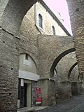
Porta Caelimontana and Porta Querquetulana were two city gates that opened in the Servian Wall in Rome (Italy); only the first one is still existing.
History
The two gates opened on the eastern side of the Caelian Hill. Only in recent times (although some doubts still persist), it has finally been established that Porta Caelimontana was the westernmost one, while Porta Querquetulana was located further east.
Until a few years ago the arguments of some scholars tended to support the exact opposite, on the basis of both toponymic and archaeological evaluations. In the absence of clear indications from the classical sources (whose quotations in this regard are almost non-existent), the hypothesis was based on the assumption that both gates derived their name from that of the hill on which they were located. Querquetulum (meaning "covered with oak woods" in Latin) was in fact the ancient name of what was only later called Caelius: it could therefore be assumed that the two gates could have been opened in succession: the Querquetulana first and then - maybe in an expansion of the Servian walls, when the oaks were no longer there - the Caelimontana.
The only surviving remains belong to the westernmost gate, still existing, which was transformed into what is currently known as the Arch of Dolabella and Silanus, and consist of blocks dating back to the beginning of the fourth century BC, when the first republican walls were built: it can be therefore deduced that this should have been Porta Querquetulana. An indirect (although a bit weak) confirmation of such conclusion is provided by Livy, who mentions Porta Caelimontana for the first time (XXXV, 9) to report a lightning that struck it in 193 BC.
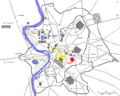
Despite some residual doubts, the hypothesis that places Porta Querquetulana to the east - within the perimeter of the current San Giovanni Hospital, close to the intersection between Via dei Santi Quattro and Via di Santo Stefano Rotondo - and Porta Caelimontana further west - at the beginning of Via San Paolo della Croce, on the route of the former Clivus Scauri - is currently more accredited. …
Text from Wikipedia, the free encyclopedia, under CC BY-SA 4.0. Full article: «Porta Caelimontana e Porta Querquetulana».
Photos
Getting there
Roma OstienseTrain, nearest
1.7 km as the crow flies
Porta Caelimontana e Porta Querquetulana
Aeroporto di Roma-Ciampino12.5 km
Distances are as the crow flies, not walking or driving.
Loading map…
Nearby
See on the mapMore fortresses and towers in Lazio


- UNESCO


Frequently asked questions
Where is Porta Caelimontana e Porta Querquetulana?
Porta Caelimontana e Porta Querquetulana is in Rome, in the province of Roma (Lazio), Italy. GPS coordinates: 41.88560, 12.49520.
How old is Porta Caelimontana e Porta Querquetulana?
Wikidata dates it to 10.
What else is there to see near Porta Caelimontana e Porta Querquetulana?
Nearby you’ll find: Arch of Dolabella (0 m away), Vicus Capitis Africae (0 m away), Basilica Hilariana (100 m away).
Sources and licences
Text. Wikipedia, the free encyclopedia (CC BY-SA 4.0).
Data. Wikidata (CC0); opening hours and contacts OpenStreetMap (ODbL).
Photos. Wikimedia Commons, author and licence on every image.
Credits for the 3 photos
- The British Library - Rome - Porta Querquetulana — The British Library, CC0
- Planrome2b — Cassius Ahenobarbus, CC BY-SA 3.0
- Porte Caelimontane externe — LPLT, CC BY-SA 3.0
Updated 28 October 2026. All sources and licences