


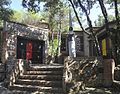


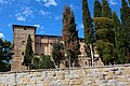


Photo: Diego_Baglieri, CC BY-SA 4.0 · Wikimedia Commons
Historic villa / palace
Municipio di Corciano
Building in Corciano, Italy
At a glance
- Style
- Mannerist architecture
- Architect
- Galeazzo Alessi
- Commissioned by
- Ascanio della Corgna
- Coordinates
- 43°07′42″ N, 12°17′11″ E
- Address
- Corso Cardinale Rotelli, 21 - 06073 Corciano (PG)
About
No English description yet
Opening hours and directions are on this page. The full story is on Italian Wikipedia.
Read it in ItalianPeople
Events and people from Wikidata (CC0).
Photos
Getting there
Ellera-CorcianoTrain, nearest
4.6 km as the crow flies
Municipio di CorcianoCorso Cardinale Rotelli, 21 - 06073 Corciano (PG)
San Feliciano9.8 km
Aeroporto Internazionale dell'Umbria - Perugia "San Francesco d'Assisi"18.4 km
Distances are as the crow flies, not walking or driving.
Loading map…
Nearby
See on the mapMore historic villas and palaces in Umbria


- Free 1st Sunday


Frequently asked questions
Where is Municipio di Corciano?
Municipio di Corciano is in Corciano, in the province of Perugia (Umbria), Italy. Address: Corso Cardinale Rotelli, 21 - 06073 Corciano (PG). GPS coordinates: 43.12843, 12.28629.
Is Municipio di Corciano wheelchair accessible?
According to OpenStreetMap data, the site is wheelchair accessible.
What else is there to see near Municipio di Corciano?
Nearby you’ll find: Castello di Pieve del Vescovo (100 m away), Museo della casa contadina (100 m away), Fuseum (4.9 km away).
Sources and licences
Data. Wikidata (CC0); opening hours and contacts OpenStreetMap (ODbL).
Photos. Wikimedia Commons, author and licence on every image.
Credits for the 3 photos
- Corciano - Palazzo della Corgna - 001 — Diego_Baglieri, CC BY-SA 4.0
- Corciano, municipio (01) — Gianni Careddu, CC BY-SA 4.0
- Corciano, palazzo comunale — sailko, CC BY-SA 3.0
Updated 28 October 2026. All sources and licences