Saved
Palazzo Arnaldi
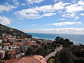
Original photo1 of 3 photos

Photo: Al*from*Lig, CC BY-SA 4.0 · Wikimedia Commons

Historic villa / palace, 17th century

Palazzo Arnaldi

Palace in Finale Ligure, Italy

Finale Ligure (SV), Liguria

Directions

At a glance

Period
Early modern period, 17th century
Protection
Italian national heritage
Coordinates
44°10′34″ N, 8°19′35″ E
Address
Via del Municipio, 1, 2, 4, 5, 7, Finale Ligure (SV)

Timeline

  1. 17th centuryBuilt

Events and people from Wikidata (CC0).

Photos

Getting there

Finale Ligure MarinaTrain, nearest
1.4 km as the crow flies
Palazzo ArnaldiVia del Municipio, 1, 2, 4, 5, 7, Finale Ligure (SV)

Distances are as the crow flies, not walking or driving.

Loading map…

Do you know this place?

We are missing the opening hours and a description. The data comes from open projects: if you add it there, it appears here at the next update.

More historic villas and palaces in Liguria

Historic villa / palace, 1783

Doge's Palace

Genoa (GE)

Accessible

See all historic villas and palaces in Liguria

Things to see in Finale Ligure: 37 historic places

Frequently asked questions

Where is Palazzo Arnaldi?

Palazzo Arnaldi is in Finale Ligure, in the province of Savona (Liguria), Italy. Address: Via del Municipio, 1, 2, 4, 5, 7, Finale Ligure (SV). GPS coordinates: 44.17618, 8.32646.

How old is Palazzo Arnaldi?

Wikidata dates it to the 17th century.

What else is there to see near Palazzo Arnaldi?

Nearby you’ll find: Convento di Santa Caterina (0 m away), Museo archeologico del Finale (0 m away), Fort San Giovanni (200 m away).

Sources and licences

Data. Wikidata (CC0); opening hours and contacts OpenStreetMap (ODbL).

Photos. Wikimedia Commons, author and licence on every image.

Credits for the 3 photos
  1. Palazzo Arnaldi, Finalborgo, Finale Ligure, Liguria — Al*from*Lig, CC BY-SA 4.0
  2. Finalborgo-palazzo1 — Davide Papalini, CC BY-SA 3.0
  3. Matteo Annibale Arnaldi — Al*from*Lig, CC BY-SA 4.0

Updated 28 October 2026. All sources and licences

Spotted a mistake? Fix it on OpenStreetMap