
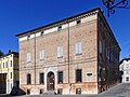




Photo: MassimoFabrizioDondi58, CC BY-SA 4.0 · Wikimedia Commons
Fortress / Tower, 15th century
Mura di cinta
City wall in Vignola, Italy
Vignola (MO), Emilia-Romagna
At a glance
- Type
- Fortress / Tower
- Period
- Middle Ages, 15th century
- Protection
- Italian national heritage
- Coordinates
- 44°28′39″ N, 11°00′27″ E
- Address
- via Tavoni ‒ Vignola (MO)
Timeline
- 16th centuryBuilt
Events and people from Wikidata (CC0).
Photos
Getting there
VignolaTrain, nearest
500 m as the crow flies
Mura di cintavia Tavoni ‒ Vignola (MO)
Aeroporto di Bologna "Guglielmo Marconi"23.1 km
Distances are as the crow flies, not walking or driving.
Loading map…
Nearby
See on the mapDo you know this place?
We are missing the opening hours and a description. The data comes from open projects: if you add it there, it appears here at the next update.
More fortresses and towers in Emilia-Romagna


Frequently asked questions
Where is Mura di cinta?
Mura di cinta is in Vignola, in the province of Modena (Emilia-Romagna), Italy. Address: via Tavoni ‒ Vignola (MO). GPS coordinates: 44.47751, 11.00749.
How old is Mura di cinta?
Wikidata dates it to the 15th century.
What else is there to see near Mura di cinta?
Nearby you’ll find: Palazzo Barozzi (200 m away), Rocca di Vignola (200 m away), Teatro Ermanno Fabbri (200 m away).
Sources and licences
Data. Wikidata (CC0); opening hours and contacts OpenStreetMap (ODbL).
Photos. Wikimedia Commons, author and licence on every image.
Credits for the 6 photos
- Vignola - Mura di cinta, torre Galvani e torre Moreni - 2023-09-15 15-01-50 005 — MassimoFabrizioDondi58, CC BY-SA 4.0
- Vignola - Mura di cinta, torre Galvani e torre Moreni - 2023-09-15 15-01-50 003 — MassimoFabrizioDondi58, CC BY-SA 4.0
- Mura cittadine (Vignola) - lato nord-ovest 1 2026-07-24 — Parma1983, CC BY-SA 4.0
- Mura cittadine (Vignola) - lato nord-ovest 2 2026-07-24 — Parma1983, CC BY-SA 4.0
- Mura cittadine (Vignola) - lato nord-ovest 3 2026-07-24 — Parma1983, CC BY-SA 4.0
- Vignola abc7 mura — Patafisik, CC BY-SA 4.0
Updated 28 October 2026. All sources and licences