


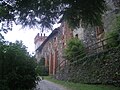


- Most beautiful villages
Photo: Hagai Agmon-Snir حچاي اچمون-سنير חגי אגמון-שניר, CC BY-SA 4.0 · Wikimedia Commons
Historic village
Italian comune
Ingria (Piedmontese: L'Ingri, Arpitan: L'Éngri) is a comune (municipality) in the Metropolitan City of Turin in the Italian region Piedmont, located about 45 kilometres (28 mi) north of Turin in the Valle Soana.
Ingria borders the following municipalities: Ronco Canavese, Traversella, Frassinetto, Pont Canavese, and Sparone. It is one of I Borghi più belli d'Italia ("The most beautiful villages of Italy").
Text from Wikipedia, the free encyclopedia, under CC BY-SA 4.0. Full article: «Ingria».
Distances are as the crow flies, not walking or driving.


Ingria is in Ingria, in the province of Torino (Piedmont), Italy. GPS coordinates: 45.46647, 7.57092.
Nearby you’ll find: Santa Maria di Doblazio (6 km away), Boira Fusca (7.7 km away), Villa Aurora (10.1 km away).
Text. Wikipedia, the free encyclopedia (CC BY-SA 4.0).
Data. Wikidata (CC0); opening hours and contacts OpenStreetMap (ODbL).
Photos. Wikimedia Commons, author and licence on every image.
Updated 28 October 2026. All sources and licences