

Photo: Sensenschmied, CC BY 3.0 · Wikimedia Commons
At a glance
- Type
- Archaeological site
- Coordinates
- 42°38′03″ N, 12°21′55″ E
History and description
Grotta Bella is a cave and archaeological site located near Avigliano Umbro in Italy. Excavations at the site have indicated that the cave was inhabited by humans from the 5th-millennium BCE to the 4th-century CE. The early population of the cave, during the Neolithic, appear to have primarily dwelled within the Entrance Hall of the site. However, it is likely that they utilized the deepest part of the cave—the Sala dello Scheletro ("Skeleton Hall")—as a burial ground. By the 6th-century BCE, the cave functioned as a religious site for the Umbrian people, who deposited numerous votives in the area. Like other Umbrian sites, the majority of the votives at Grotta Bella were composed of bronze, although—unlike most Umbrian sites—the cave contained multiple votives fashioned from lead. The site remained active following the Roman conquest and persisted until at least the 4th-century CE, although usage of the cave declined significantly following Roman occupation.
Terrain
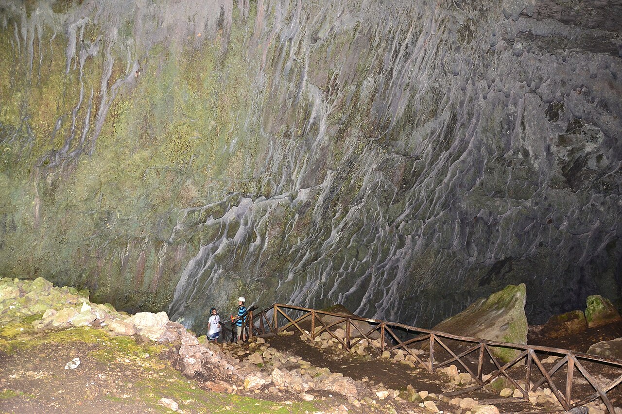
The site is situated on the northeastern side of the Monte L’Aiola, which is itself within the Amerini mountain range. The entrance of the cave directly leads into the first room: The so-called "Entrance Hall," which is forty meters wide at its major axis, thirty meters wide at its minor axis, and—on average—ten meters tall. At the southern end of the Entrance Hall, the cave splits into three divergent paths. One such route, the "Condotta Preistorica" ("Prehistoric passageway"), leads into the Sala dello Scheletro ("Skeleton Hall"), which is located thirty-one meters below the entrance in elevation and is currently the deepest known part of the cave. Nearby the Prehistoric passageway lies the "Ramo delle Firme ("Signature Branch")," named so for the presence of numerous signatures inscribed into the walls by the various individuals who have entered the cave over the centuries. The Signature Branch leads into two additional areas: The "Diverticolo delle firme" ("Side passageway of the Signature Branch") and the "Sala Santa Restituta" ("Hall of Santa Restituta"), which is located thirty meters below the entrance. The "Via delle Strettoie" ("Narrow Passageway") is situated to the east of the Signature Branch and consists of various pathways that are difficult to navigate.
Archaeology
The site was first recorded in 1902 by the geologist Bernardino Lotti, although the area was not extensively analyzed until the 1950s, when a team of speleologists examined and mapped the cave. Archaeological excavations were first conducted at the site from 1970-1973 by the University of Milan and the Soprintendenza per i Beni Archeologici dell’Umbria. Later excavations conducted by the Gruppo Speleologico Todi in the 1990s explored the deepest layers of the site, uncovering new areas in the process, such as the Skeleton Hall. This same area was reexamined from 2019-2021 by the Enzo dei Medici, an Italian organization dedicated to speleological research.
Archaeological investigation of the site has indicated that the cave was occupied by various peoples from the 5th-millennium BCE to the 4th-century CE. Human habitation in the cave, during the Neolithic, was primarily concentrated within the immediate entrance hall. The material of this area was characterized by domestic items such as hearths, the remains of meals, stone or metal tools, millstones, obsidians, flints, and painted wares. Besides the natural shelter provided by any cave, it is likely that Grotta Bella was particularly attractive to early humans because the entrance section was thoroughly lit by sunlight and because—during wet seasons—water would accumulate on and drip from the stalactites, thereby providing an accessible, albeit seasonal, source of water. In contrast to the relatively accommodating entrance area, the deepest known section of the cave—the Skeleton Hall—was devoid of natural light and difficult to navigate. This area likely lacked any significant human settlement, though it was probably utilized as a burial ground by the prehistoric population of the site, as multiple bones belong to at least nine separate individuals were uncovered within this remote section of the cave. The presence of domestic animal bones at the site may indicate that the area was frequented by farmers during the Middle Neolithic. …
Text from Wikipedia, the free encyclopedia, under CC BY-SA 4.0. Full article: «Grotta Bella».
Getting there
AlvianoTrain, nearest
9.9 km as the crow flies
Grotta Bella
Distances are as the crow flies, not walking or driving.
Loading map…
Nearby
See on the mapMore archaeological sites in Umbria


Frequently asked questions
Where is Grotta Bella?
Grotta Bella is in Avigliano Umbro, in the province of Terni (Umbria), Italy. GPS coordinates: 42.63429, 12.36535.
What else is there to see near Grotta Bella?
Nearby you’ll find: Carnano Castle (6.9 km away), Montecchio (7.1 km away), Necropoli del Vallone San Lorenzo (7.1 km away).
Sources and licences
Text. Wikipedia, the free encyclopedia (CC BY-SA 4.0).
Data. Wikidata (CC0); opening hours and contacts OpenStreetMap (ODbL).
Photos. Wikimedia Commons, author and licence on every image.
Credits for the 1 photos
- Grotta Bella — Sensenschmied, CC BY 3.0
Updated 28 October 2026. All sources and licences