




Photo: C. Schuhmacher, CC BY-SA 3.0 · Wikimedia Commons
Lighthouse, 1913
Punta Tagliamento Lighthouse
Lighthouse in Italy
At a glance
- Type
- Lighthouse
- Period
- Modern era, 1913
- Materials
- Concrete
- Coordinates
- 45°38′11″ N, 13°05′51″ E
History and description
Punta Tagliamento Lighthouse (Italian: Faro di Punta Tagliamento) is a lighthhose in Bibione a frazione of San Michele al Tagliamento, Veneto on the coast of the Adriatic Sea. It is placed on the beach protected by several seawalls placed as erosion control.
History
The lighthouse was built in 1913 on the Venetian side of the mouth of the Tagliamento river, which at that time was the northern border of the Kingdom of Italy. In 1917 the light was destroyed by a bombing during World War I but it was suddenly rebuilt; in 1952 the plant was electrified and in 1973 was completely automated.
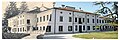
The lighthouse is formed by a concrete white tower 21 metres (69 ft) high adjacent to a two-story white and ochre keeper's house completely restored in June 2015 which will be used in part to accommodate a Museum, cultural events and to celebrate marriage too.
The light is active, fully automated and operated by Marina Militare identified by the code number 4288 E.F.
Text from Wikipedia, the free encyclopedia, under CC BY-SA 4.0. Full article: «Punta Tagliamento Lighthouse».
Timeline
- 1913Built
Events and people from Wikidata (CC0).
Photos
Getting there
X-River Bibione1.2 km
Trieste Airport35.7 km
Distances are as the crow flies, not walking or driving.
Loading map…
Nearby
See on the mapMore lighthouses in Veneto


Frequently asked questions
Where is Punta Tagliamento Lighthouse?
Punta Tagliamento Lighthouse is in San Michele al Tagliamento, in the province of Venezia (Veneto), Italy. GPS coordinates: 45.63629, 13.09751.
Is Punta Tagliamento Lighthouse wheelchair accessible?
According to OpenStreetMap data, the site is not wheelchair accessible.
How old is Punta Tagliamento Lighthouse?
Wikidata dates it to 1913.
What else is there to see near Punta Tagliamento Lighthouse?
Nearby you’ll find: Villa Romana Motteron dei Frati (4.6 km away), Caorle Lighthouse (16.4 km away), Liturgical Museum of Caorle (16.7 km away).
Sources and licences
Text. Wikipedia, the free encyclopedia (CC BY-SA 4.0).
Data. Wikidata (CC0); opening hours and contacts OpenStreetMap (ODbL).
Photos. Wikimedia Commons, author and licence on every image.
Credits for the 6 photos
- Bibione leuchtturm — C. Schuhmacher, CC BY-SA 3.0
- Faro di Punta Tagliamento — Foce del tagliamento, CC BY-SA 4.0
- Phare de Punta Tagliamento (22907) — Đuro Jiří, CC BY-SA 4.0
- Leuchtturm Bibione 2016 — Picsforjoo, CC BY-SA 4.0
- Maják - panoramio — Koni Pas, CC BY 3.0
- Watch light in bibione — Izmaelt, Public domain
Updated 28 October 2026. All sources and licences