

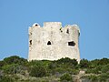




Photo: Gianni Careddu, CC BY-SA 3.0 · Wikimedia Commons
Lighthouse, 1864
Cap de Caça Lighthouse
Lighthouse in l'Alguer, Italy
At a glance
- Type
- Lighthouse
- Period
- Modern era, 1864
- Coordinates
- 40°33′38″ N, 8°09′47″ E
History and description
Capo Caccia Lighthouse (Algherese Catalan: Far del Cap de Caça, Italian: Faro di Capo Caccia) is an active 19th century lighthouse situated at the extremity of Capo Caccia, 3.7 kilometres (2.3 mi) from Tramariglio a frazione of Alghero on the western coast of Sardinia.
Description
The lighthouse was built in 1864 on the top of the namesake promontory overlooking the sea, just above Neptune's Grotto connected by s staircase of 656 steps named Escala de Cabirol (Staircase of roe). The light station is a three-story white building protected by a Faraday cage to defend from the lightning strikes; above the keeper's house stands the tower 24 metres (79 ft) high, which was rebuilt in 1950s, bringing the focal height to 186 metres (610 ft) making it the highest lighthouse in Italy.
The lantern was supplied by various fuels, including acetylene up to 1880, and then by petroleum gas, until in 1961 the plant was electrified. The rotating optic which was built in Paris by Barbier, Benard, et Turenne in 1951, is equipped with a Fresnel lens, with four deflectors at 90° to each other with a focal distance of 375 millimetres. The lighthouse is active, fully automated, even if staffed by the two keepers who also have the task of maintaining the other lighthouses along the western Sardinia coast. It is operated by Marina Militare identified by the code number 1418 E.F.
Text from Wikipedia, the free encyclopedia, under CC BY-SA 4.0. Full article: «Cap de Caça Lighthouse».
Timeline
- 1864Built
Events and people from Wikidata (CC0).
Photos
Getting there
AlgheroTrain, nearest
13.5 km as the crow flies
Cap de Caça Lighthouse
Aeroporto di Alghero-Fertilia13.5 km
Distances are as the crow flies, not walking or driving.
Loading map…
Nearby
See on the mapMore lighthouses in Sardinia


Frequently asked questions
Where is Cap de Caça Lighthouse?
Cap de Caça Lighthouse is in Alghero, in the province of Sassari (Sardinia), Italy. GPS coordinates: 40.56061, 8.16294.
How old is Cap de Caça Lighthouse?
Wikidata dates it to 1864.
What else is there to see near Cap de Caça Lighthouse?
Nearby you’ll find: Torre del Bol (1.3 km away), Torre di Tramariglio (3 km away), Torre de la Punta del Lliri (3.6 km away).
Sources and licences
Text. Wikipedia, the free encyclopedia (CC BY-SA 4.0).
Data. Wikidata (CC0); opening hours and contacts OpenStreetMap (ODbL).
Photos. Wikimedia Commons, author and licence on every image.
Credits for the 6 photos
- Alghero - Faro di capo Caccia (03) — Gianni Careddu, CC BY-SA 3.0
- Alghero - Faro di capo Caccia (01) — Gianni Careddu, CC BY-SA 3.0
- Cap de la Caça - Capo Caccia (l'Alguer) (34539645414) — Teresa Grau Ros from Barcelona, CC BY-SA 2.0
- Faro di Capo Caccia — Boboseiptu, CC BY-SA 4.0
- Capo Caccia dal mare — Stefano Fiaschi, CC BY-SA 2.5
- Capo Caccia visto da Alghero — Basilicofresco, CC BY-SA 4.0
Updated 28 October 2026. All sources and licences