At a glance
- Architect
- Giovanni Coccapani
- Coordinates
- 43°46′17″ N, 11°16′06″ E
About
No English description yet
Opening hours and directions are on this page. The full story is on Italian Wikipedia.
Read it in ItalianPeople
Events and people from Wikidata (CC0).
Getting there
Firenze Campo di MarteTrain, nearest
1.0 km as the crow flies
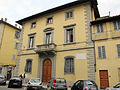
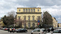
Former church of Santa Teresa
Aeroporto Firenze Amerigo Vespucci6.7 km
Distances are as the crow flies, not walking or driving.
More abbeys and monasteries in Tuscany
Abbey / Monastery, 1869 Florence (FI)
Opening hours
Abbey / Monastery, 1891 Florence (FI)
Opening hoursFree entry
Abbey / Monastery Pisa (PI)
Opening hours
Abbey / Monastery, 1260 Chiusi della Verna (AR)
Abbey / Monastery, 1252 Florence (FI)
Abbey / Monastery, 13th century Chiusdino (SI)
See all abbeys and monasteries in Tuscany
Things to see in Florence: 914 historic places
Frequently asked questions
Where is Former church of Santa Teresa?
Former church of Santa Teresa is in Florence, in the province of Firenze (Tuscany), Italy. GPS coordinates: 43.77152, 11.26831.
What else is there to see near Former church of Santa Teresa?
Nearby you’ll find: Palazzina Torsellini delle Ruote (100 m away), Palazzina Marchesini (100 m away), Palazzina Francolini (100 m away).
Sources and licences
Data. Wikidata (CC0); opening hours and contacts OpenStreetMap (ODbL).
Photos. Wikimedia Commons, author and licence on every image.
Credits for the 5 photos
- Monastero di Santa teresa — Sailko, CC BY-SA 3.0
- Borgo la croce 30, santa teresa — sailko, CC BY-SA 3.0
- Largo annigoni, verso santa teresa — sailko, CC BY-SA 3.0
- Santa teresa, fi, 00 — sailko, CC BY-SA 3.0
- Via della mattonaia, targhe ss. otto su s. teresa — sailko, CC BY-SA 3.0
Updated 28 October 2026. All sources and licences
Spotted a mistake? Fix it on OpenStreetMap