


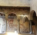


Photo: hozinja, CC BY 2.0 · Wikimedia Commons
Fortress / Tower
Città Alta
Historic city centre of Bergamo, Italy, located within city walls on the hills ca. 90 m above the Lower Town parts of Bergamo
At a glance
- Type
- Fortress / Tower
- Elevation
- 356 m above sea level
- Coordinates
- 45°42′14″ N, 9°39′46″ E
Photos
Getting there
BergamoTrain, nearest
1.8 km as the crow flies
Città Alta
Aeroporto Militare Antonio Locatelli4.2 km
Distances are as the crow flies, not walking or driving.
Loading map…
Nearby
See on the mapDo you know this place?
We are missing the opening hours and a description. The data comes from open projects: if you add it there, it appears here at the next update.
More fortresses and towers in Lombardy


- UNESCO

- UNESCO

- UNESCO

Frequently asked questions
Where is Città Alta?
Città Alta is in Bergamo, in the province of Bergamo (Lombardy), Italy. GPS coordinates: 45.70390, 9.66290.
What else is there to see near Città Alta?
Nearby you’ll find: Palazzo del Podestà (0 m away), Palazzo della Ragione (0 m away), Fresco Museum of Bergamo (0 m away).
Sources and licences
Data. Wikidata (CC0); opening hours and contacts OpenStreetMap (ODbL).
Photos. Wikimedia Commons, author and licence on every image.
Credits for the 9 photos
- Sunrise at Bergamo old town, Lombardy, Italy — hozinja, CC BY 2.0
- Bergamo - Città alta — Berengario Alcontres, CC BY-SA 4.0
- Bergamo Città Alta — Rollroboter, CC BY-SA 4.0
- Bergamo, Città alta (1) — -jkb-, CC BY-SA 3.0
- Bergamo, Città Alta, Piazza Vecchia, Palazzo Della Ragione — Gianluigi Buttarelli, CC BY 4.0
- Citta Alta (31915455765) — Marco Nürnberger from Nuremberg, Germany, CC BY 2.0
- Città Alta, Bergamo (15860193664) — Luca Serazzi from Bergamo, Italy, CC BY 2.0
- Citta Alta, Bergamo (2792725356) — David Spender from United Kingdom, CC BY 2.0
- Città Alta, Bergamo BG, Italy - panoramio (13) — Ben Bender, CC BY-SA 3.0
Updated 28 October 2026. All sources and licences