

- UNESCO
- Free 1st Sunday
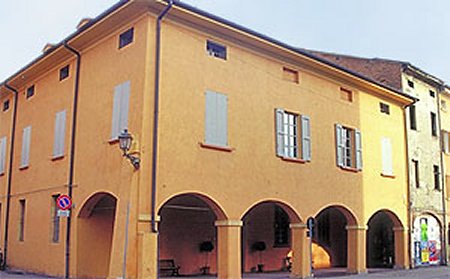
Photo: Inconnu, Public domain · Wikimedia Commons
Abbey / Monastery, 10th century
Church in S. Maria in Strada - Anzola dell'Emilia (BO)
Events and people from Wikidata (CC0).
Distances are as the crow flies, not walking or driving.
 Gelato Museum Carpigiani5.3 km
 Teatro Comunale7.8 km
 Ex Convento ed ex Chiesa di San Francesco ai Frati7.8 km
 Palazzo Piella8.7 km
 Museo civico archeologico Anton Celeste Simonini8.7 km
We are missing the opening hours and a description. The data comes from open projects: if you add it there, it appears here at the next update.


Chiesa di Santa Maria in Strada is in Anzola dell'Emilia, in the province of Bologna (Emilia-Romagna), Italy. Address: via Stradellazzo 25‒ S. Maria In Strada ‒ Anzola dell'Emilia (BO). GPS coordinates: 44.57167, 11.15889.
Wikidata dates it to the 10th century.
Nearby you’ll find: Gelato Museum Carpigiani (5.3 km away), Museo del Cielo e della Terra (7.4 km away), Teatro Comunale (7.8 km away).
Data. Wikidata (CC0); opening hours and contacts OpenStreetMap (ODbL).
Photos. Wikimedia Commons, author and licence on every image.
Updated 28 October 2026. All sources and licences