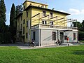
At a glance
- Protection
- Italian national heritage
- Coordinates
- 46°11′15″ N, 13°18′57″ E
- Address
- Via Porzus
About
No English description yet
Opening hours and directions are on this page. The full story is on Italian Wikipedia.
Read it in ItalianGetting there
Tricesimo - San PelagioTrain, nearest
7.0 km as the crow flies
Castello InferioreVia Porzus
Distances are as the crow flies, not walking or driving.
Things to see in Attimis: 6 historic places
Frequently asked questions
Where is Castello Inferiore?
Castello Inferiore is in Attimis, in the province of Udine (Friuli Venezia Giulia), Italy. Address: Via Porzus. GPS coordinates: 46.18763, 13.31584.
What else is there to see near Castello Inferiore?
Nearby you’ll find: Castello Partistagno (1.2 km away), Castle of Cergneu (2.9 km away), Castello della Motta (4.3 km away).
Sources and licences
Data. Wikidata (CC0); opening hours and contacts OpenStreetMap (ODbL).
Photos. Wikimedia Commons, author and licence on every image.
Credits for the 9 photos
- Mastio del castello inferiore di Attimis — Matteo.digiorgio99, CC BY-SA 4.0
- Castello Inferiore di Attimis - Torre — Francezeta, CC BY-SA 4.0
- Castello inferiore di Attimis — Cascafico, CC0
- Castello inferiore informazioni — Matteo.digiorgio99, CC BY-SA 4.0
- Feritoia del castello di Attimis Inferiore. — CorinCap22, CC BY-SA 4.0
- I resti della torre del castello di Attimis Inferiore. — CorinCap22, CC BY-SA 4.0
- Piantina Castello Inferiore Attimis — Matteo.digiorgio99, CC BY-SA 4.0
- Piccola apertura ad arco nel castello di Attimis Inferiore — CorinCap22, CC BY-SA 4.0
- Schizzo riproducente l'aspetto del Castello Inferiore di Attimis — Matteo.digiorgio99, CC BY-SA 4.0
Updated 28 October 2026. All sources and licences
Spotted a mistake? Fix it on OpenStreetMap