


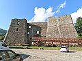


Castle, Bedonia (PR)
44°30′22″ N, 9°34′58″ E
No photo on Wikimedia Commons yet
Castle, 11th century
Castello di Montarsiccio
Castle in Montarsiccio - Bedonia (PR)
Bedonia (PR), Emilia-Romagna
At a glance
- Type
- Castle
- Period
- Middle Ages, 11th century
- Protection
- Italian national heritage
- Coordinates
- 44°30′22″ N, 9°34′58″ E
- Address
- ‒ Montarsiccio ‒ Bedonia (PR)
Timeline
- 11th centuryBuilt
Events and people from Wikidata (CC0).
Getting there
Address
‒ Montarsiccio ‒ Bedonia (PR)
Our data shows no stations, stops or car parks nearby. Check how to get there before you set out.
Loading map…
The town
 Things to see in Bedonia3,111 inhabitants, 500 m above sea level. 4 historic places in the town.PhotoJ.P.Lon, CC BY 3.04 places
Nearby
See on the mapDo you know this place?
We are missing the opening hours, a description and photos. The data comes from open projects: if you add it there, it appears here at the next update.
More castles in Emilia-Romagna

- Free 1st Sunday


Frequently asked questions
Where is Castello di Montarsiccio?
Castello di Montarsiccio is in Bedonia, in the province of Parma (Emilia-Romagna), Italy. Address: ‒ Montarsiccio ‒ Bedonia (PR). GPS coordinates: 44.50605, 9.58267.
How old is Castello di Montarsiccio?
Wikidata dates it to the 11th century.
What else is there to see near Castello di Montarsiccio?
Nearby you’ll find: Seminario vescovile (3.9 km away), Castle of Compiano (6.4 km away), Compiano (6.4 km away).
Sources and licences
Data. Wikidata (CC0); opening hours and contacts OpenStreetMap (ODbL).
Updated 28 October 2026. All sources and licences