

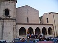
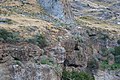


Photo: Luigino C., CC BY-SA 3.0 · Wikimedia Commons
At a glance
- Type
- Castle
- Elevation
- 149 m above sea level
- Protection
- Italian national heritage
- Coordinates
- 39°08′15″ N, 16°04′31″ E
- Address
- Via del Castello
History and description
The Amantea Castle (formerly Regio castello di Amantea) is located in the town of the same name, in the province of Cosenza, in the lower Tyrrhenian Sea of Cosenza. Dominating the coastal road and the road to Cosenza that runs along the Catocastro River valley, it was once an important stronghold under the Byzantines, Arabs, Normans, Swabians, Angevins and Aragonese. It was restored in the viceregal period and under the Bourbons, but suffered severe damage during the earthquakes of 1638 and 1783; it was left in a state of neglect after the disastrous 1806-1807 siege suffered by Napoleonic troops.
Currently the castle is in ruins, and access to the remains on the hill overlooking the city is strenuous and dangerous. In 2008, ownership of the surrounding area was acquired by the City of Amantea.
History
In ancient times the city of Lampeteia or Clampetia, a probable Crotonian colony also inhabited by indigenous Bruttian people, stood in Amantean territory. This city, already decaying in the imperial age, was wiped out by the earthquake and tidal wave of 365: a new city, Nepetia ("new city" or "new camp" in Greek), arose in its vicinity. Nepetia was occupied by the Byzantines and after 553 it was the seat of a military governorate and a stronghold on the northern borders of the theme of Calabria.
It was therefore the Byzantines who first fortified the site of present-day Amantea: however, the present name was given to the town by Arab rule. In 846, in fact, Nepetia was conquered by the Arabs of Sicily and renamed "Al-Mantiah," "the fortress." Amantea remained Arab for forty years, and was the seat of an emirate: the name of only one emir is known, As-Sinsim, latinized as Cincimo, who in 868 went so far as to attempt the conquest of Cosenza. The Byzantines reconquered the city in the year 272 of the Hijrah, that is, 885-886. Amantea became an episcopal see, and in the 10th century it incorporated into its diocese the territory of the episcopal see of the now-decayed city of Temesa.
The Emir of Sicily Abu l-Qasim Ali reconquered Amantea in 976, and it was again under Arab rule until 1031-1032, when it was again occupied by the Byzantines.
The Normans conquered Amantea in 1060-1061, driving out the Byzantines once and for all. In 1094 the diocese of Amantea was aggregated with that of Tropea, as part of the Latinization of cults in southern Italy desired by the papacy and the Norman rulers. During Norman rule Amantea decayed, replaced as an important center of control of the territory by nearby Aiello Calabro.
Under Swabian rule the castle was strengthened, as part of the plan of repopulation of the coastal areas desired by Frederick II. By virtue of the Swabian good governance, Amantea and other castles in the area (Aiello, Cleto) tenaciously resisted the new French-born ruler Charles I of Anjou: the latter sent Count Pietro Ruffo of Catanzaro to reconquer the city, which resisted the overwhelming Angevin forces throughout May 1269, before capitulating in mid-June of that year. The rebels were almost all atrociously punished. …
Description
The castle occupies a plateau with a beautiful view of both the small gulf of the Oliva River on the Tyrrhenian Sea (and on north wind days it is even possible to see the island of Stromboli and Pizzo), and the valley of the Catocastro River, through which one reaches Cosenza along the ancient route of the via Popilia.
It was probably in the Norman and Swabian ages that the southern part of the hill was heavily fortified, decentralized with respect to the built-up area, but aimed at the objectives that were of interest to keep under control at that time, namely the communication routes between the coast and the interior.
The northwest-facing oval keep, known as San Nicola, was built in the Angevin age, judging by the coat of arms bearing the fleurs-de-lis of France that remains on it; and also in the Angevin age, apparently during the reign of Joanna I of Naples, the circular tower overlooking the sea was built, isolated from the actual fortified complex. This tower is similar in construction technique to that of the castle of Paola.
In the Aragonese period the castle was modernized according to the dictates of Francesco di Giorgio Martini and of " modern-style fortification," in order to resist the shots of the new firearms: the walls were lowered but reinforced in thickness, an access ravelin was built on the eastern side (now completely collapsed), and a rampart was built that preceded the moat along its entire length. The castle was bastioned, as already mentioned, in 1538-1544, by well-known architects such as Buzzacarrino and Gian Giacomo dell'Acaya: today the large south-facing bastion is almost entirely preserved, resting on the living rock of the cliff, a formidable defense in itself. …
Text from Wikipedia, the free encyclopedia, under CC BY-SA 4.0. Full article: «Amantea Caslte».
Photos
Getting there
AmanteaTrain, nearest
700 m as the crow flies
Amantea CaslteVia del Castello
Aeroporto Internazionale di Lamezia Terme29.7 km
Distances are as the crow flies, not walking or driving.
Loading map…
Nearby
See on the mapMore castles in Calabria


Frequently asked questions
Where is Amantea Caslte?
Amantea Caslte is in Amantea, in the province of Cosenza (Calabria), Italy. Address: Via del Castello. GPS coordinates: 39.13761, 16.07518.
What else is there to see near Amantea Caslte?
Nearby you’ll find: Palazzo delle Clarisse (400 m away), Chiesa di San Bernardino da Siena (400 m away), Palazzo Rivellino (2.9 km away).
Sources and licences
Text. Wikipedia, the free encyclopedia (CC BY-SA 4.0).
Data. Wikidata (CC0); opening hours and contacts OpenStreetMap (ODbL).
Photos. Wikimedia Commons, author and licence on every image.
Credits for the 2 photos
- Amantea — Luigino C., CC BY-SA 3.0
- Castello di Amantea 01 — Dario Crespi, CC BY-SA 4.0
Updated 28 October 2026. All sources and licences