


Photo: Llorenzi, CC BY-SA 3.0 · Wikimedia Commons
Castle
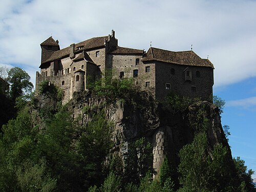
Welfenstein Castle
Building in Freienfeld, Italy
At a glance
- Type
- Castle
- Protection
- Cultural heritage monument in South Tyrol
- Coordinates
- 46°51′27″ N, 11°30′42″ E
About
No English description yet
Opening hours and directions are on this page. The full story is on Italian Wikipedia.
Read it in ItalianPhotos
Getting there
Freienfeld - Campo di TrensTrain, nearest
2.2 km as the crow flies
Welfenstein Castle
Distances are as the crow flies, not walking or driving.
Loading map…
Nearby
See on the mapMore castles in Trentino-South Tyrol



Frequently asked questions
Where is Welfenstein Castle?
Welfenstein Castle is in Freienfeld, in the province of Bolzano (Trentino-South Tyrol), Italy. GPS coordinates: 46.85754, 11.51157.
What else is there to see near Welfenstein Castle?
Nearby you’ll find: Reifenstein Castle (5.6 km away), Castle Moos (6.7 km away), Sterzing (7.4 km away).
Sources and licences
Data. Wikidata (CC0); opening hours and contacts OpenStreetMap (ODbL).
Photos. Wikimedia Commons, author and licence on every image.
Credits for the 8 photos
- Castel Guelfo3 — Llorenzi, CC BY-SA 3.0
- Edgar Meyer watercolour Welfenstein Castle — Edgar Meyer, Public domain
- Stazione di Mules - Fermata vista da nord e sullo sfondo castel Welfenstein — Llorenzi, CC BY-SA 4.0
- Burg Welfenstein 125DSC 0226 (49314292793) — János Korom Dr. >17 Million views from Wien, Austria, CC BY-SA 2.0
- Burg Welfenstein DSC 0227 (49314786691) — János Korom Dr. >17 Million views from Wien, Austria, CC BY-SA 2.0
- Castel Guelfo11 — Llorenzi, CC BY-SA 3.0
- Freienfeld, BZ - Valgenäun Ri SO, Burg Welfenstein, Sachsenklemme, Brennerautobahn — Flodur63, CC BY-SA 4.0
- Opera 1bis.2mules — Llorenzi, CC BY-SA 3.0
Updated 28 October 2026. All sources and licences